Rides We Like: Upstate New York – Chapter Two: Whiteface Mountain Veteran's Memorial Highway
(2017) In southeastern France is the Alpe d'Huez, a coveted climb among cycling’s Tour de France fans. It is a monstrous ascent at average eight percent steepness for eight miles. With twenty-one switchbacks it is usually pegged as the Queen climb of the Tour, or the stage with the most vertical climbing in one day. Sometimes the stage finishes atop the mountain, other times the riders go down the other side toward the finish line in some other town. In 2013 race organizers thought it would be nice to send the riders over Alpe d’Huez twice in one day.
Often when watching the Olympics or other pro events I ask myself how I would compare to those in the arena. How fast would I circle the velodrome? What would my average speed be in the time trial? What would my time be to those climbing Alpe d’Huez in the Tour? Short of flying to France and riding my bike up it, there are scant ways to produce a satisfying answer. Unless one heads to Upstate New York.
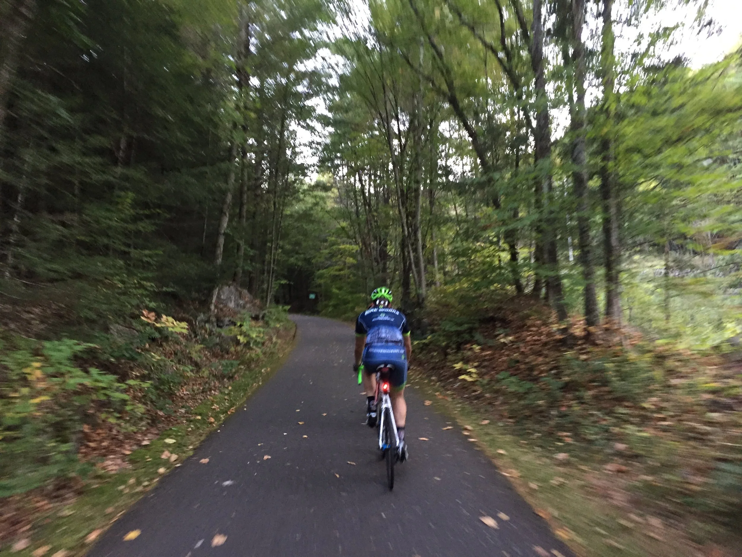
Our view along River Road just outside of Lake Placid, NY, gave us one of the first views of Whiteface, which we set out to climb by bike.
Located toward the top of the Adirondack Park, Whiteface Mountain commands much of the skyline. For the seven riders who made the drive from Philadelphia to explore our Tour climbing abilities, it mocked us. Nearly every road we took, the summit weather station peered down at us. Unafraid we returned the stare. We held its gaze as we pierced the crisp morning air on Saturday September 23, and rode to the commencement point of the mountain on the first full day of fall. Many among us had prepped specifically for this climb. We were about to learn how well we compared to the pros.
Whiteface Veteran’s Memorial Highway is similar to Alpe d’Huez. Both roads average eight percent gradient for its length. Whiteface measures slightly longer at exactly eight miles (12.8 kilometers). Alpe d’Huez is one-tenth of a mile shorter (12.7 kilometers). While Alpe d’Huez is nominally shorter, its climb starts higher above sea level at 2,150 feet. Whiteface Mountain’s climb commences just over 1,000 feet above sea level. Arguably Whiteface is more bullish considering the fact there are hardly any switchbacks to elevate the gradient. Often I would turn a corner and see a long grinding straightaway of uphill ahead.
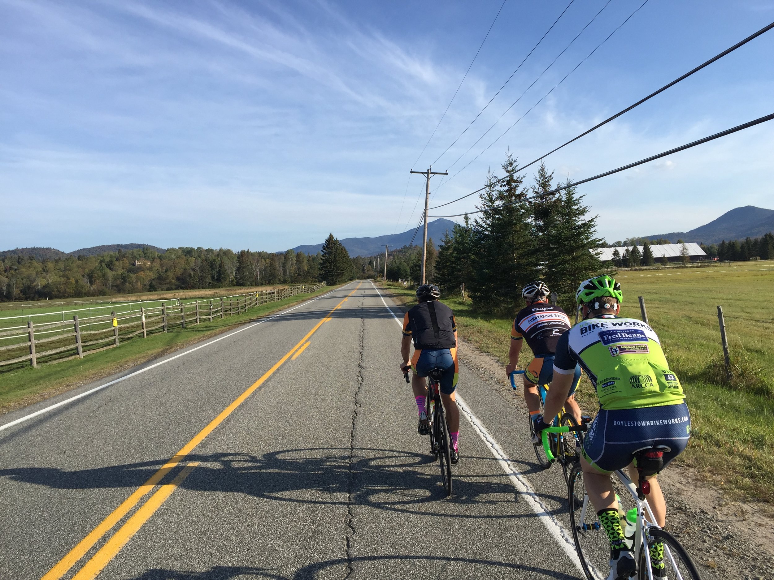
From River Road we continued to easily descend toward Wilmington via Route 86. The mountain view lurked here, too. Yes that is a cone in the photo. A relay running event climbed 'The Notch' out of Wilmington and the cones marked the course. We decided it was safer to ride on the shoulder-side of the cones.
There were seven of us, including your muse. We had Glenn, Brian, and Chris. We also had Josh and Eric, two riders we had talked about in prior articles. Of course tagging along was our hero, Mike. A little bit about Mike, his excitement drove this weekend forward. He had targeted this climb as his late season goal. He had never been up this mountain before. For me, that made the experience worth it. All of us in the group were about to experience professional gradient riding.
No sooner did we hit the lower slopes of the road up Whiteface and I found myself peeling off the front. I knew my place. These guys were excited to go up for the better part of an hour. I have never understood those who enjoy climbing, so I politely removed myself from the fricassee and tried to latch onto the last wheel. It was remarkable how fast the group moved away from me.
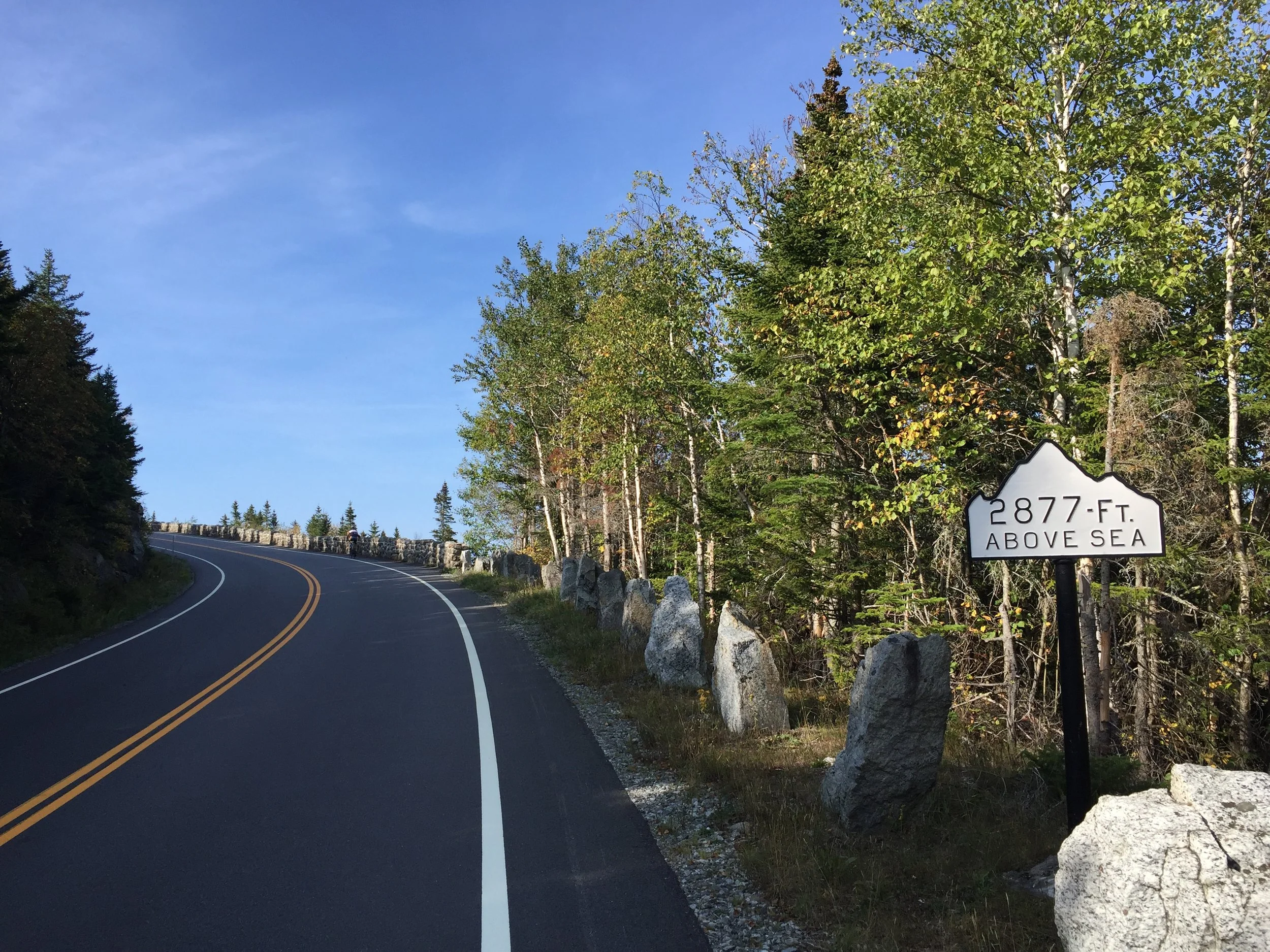
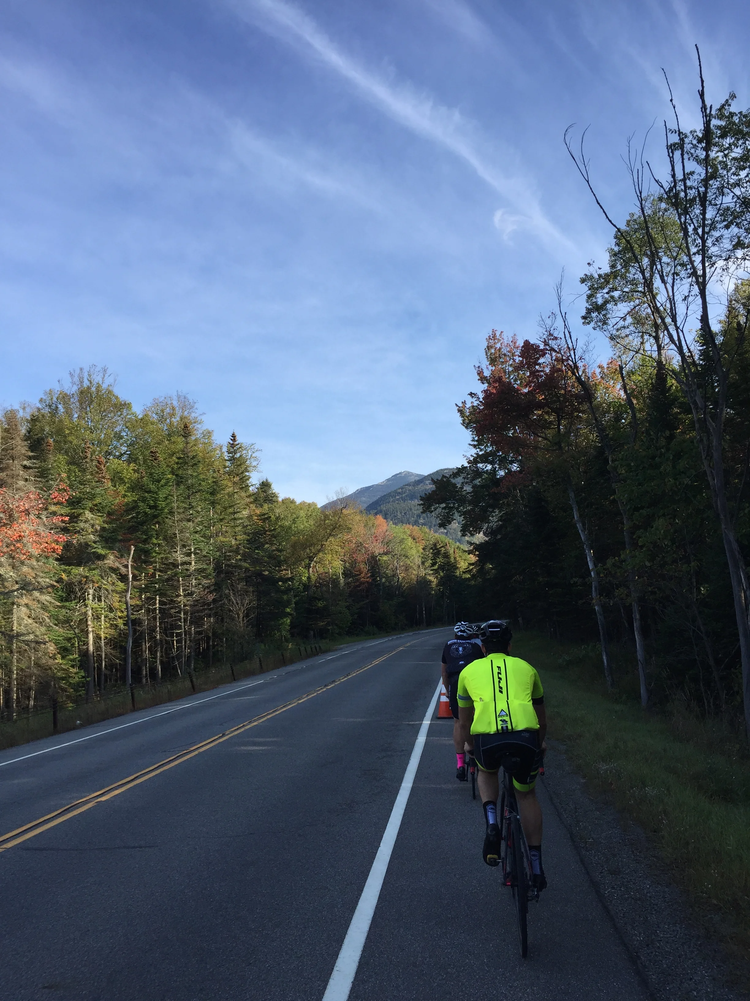
Shortly after passing through the tollbooth, signs began to pop up letting the visitor know his/ her elevation. The temperature began to moderate through the shadows giving the group favorable conditions.
Alone, I maintained a monologue of thoughts. I tried to figure out if having a cycling computer would be beneficial. Sure the cadence would help. Certainly the wattage would be key if the information were correct. But would a distance tracker make the climb more agonizing? Why would I want to look down frequently to see I had moved in tenths of a mile instead of quarters of a mile? With a computer I would concern myself with data and not the earned views. The harder the climb, the more I stare at my computer? I concluded the argument void since I was not riding with one today.
On the repaved ribbon of road there are no markers to indicate progress. There is only one concrete marker: the tollbooth at mile three to officially enter the Veteran’s Memorial Highway. For a cyclist the mountain charges a fair $8 to climb the remaining five miles. Some questions arose. Can cyclists go up when the mountain is open to cars? A recent policy change now lets cars and cyclists go up together. In the past cyclists would have to arrive earlier than cars to go up unmolested. It is also possible to obtain a pass prior to climbing. Simply drive to the tollbooth and indicate your desire to come back and climb via bike. Then display the ticket as you pass the tollbooth to continue upward.
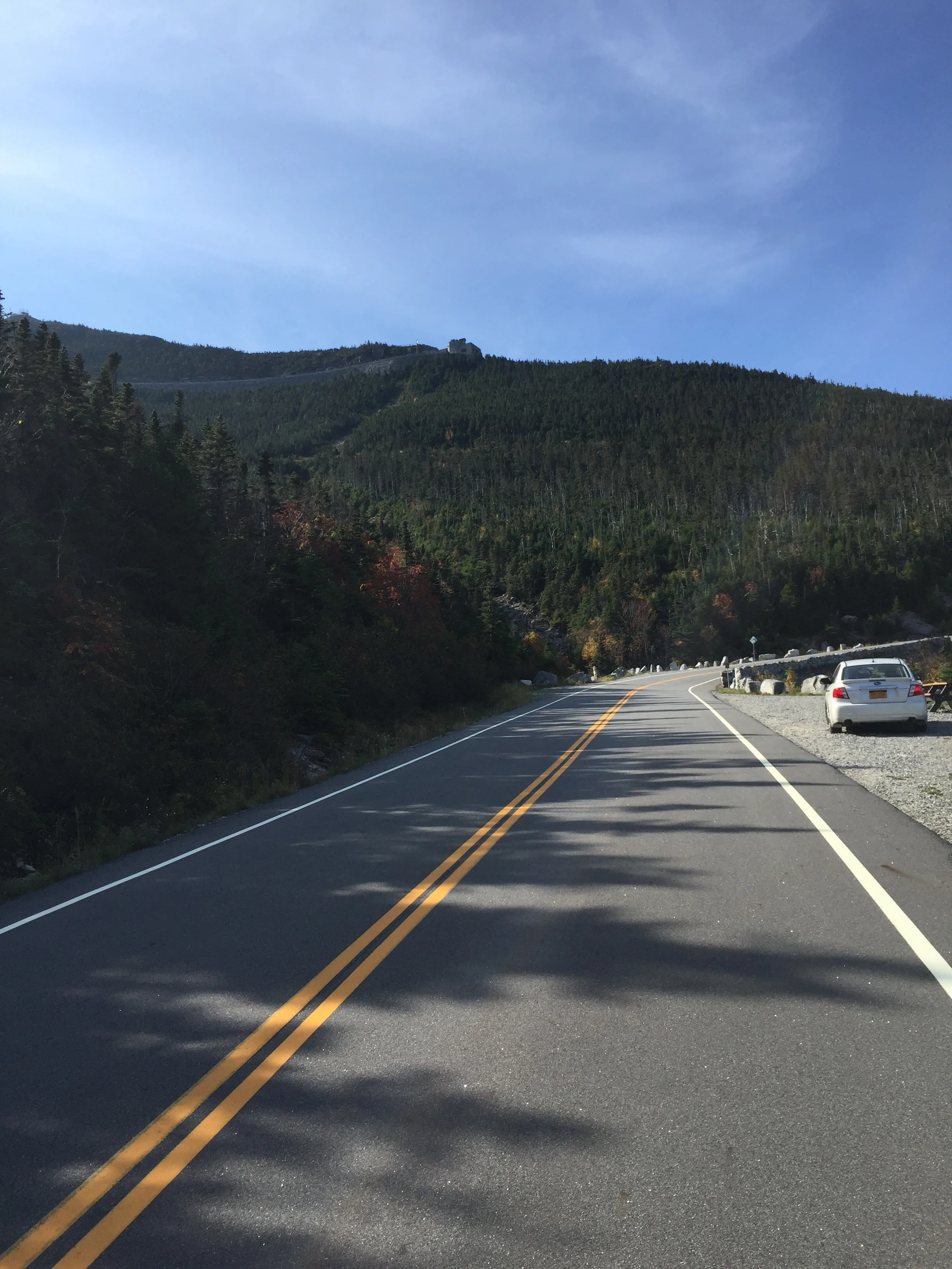
Shortly after emerging from the treeline, we were given a visual cue as to just how much effort would be required to get to the top way in the distance. The diagonal cut below the summit is the highway itself.
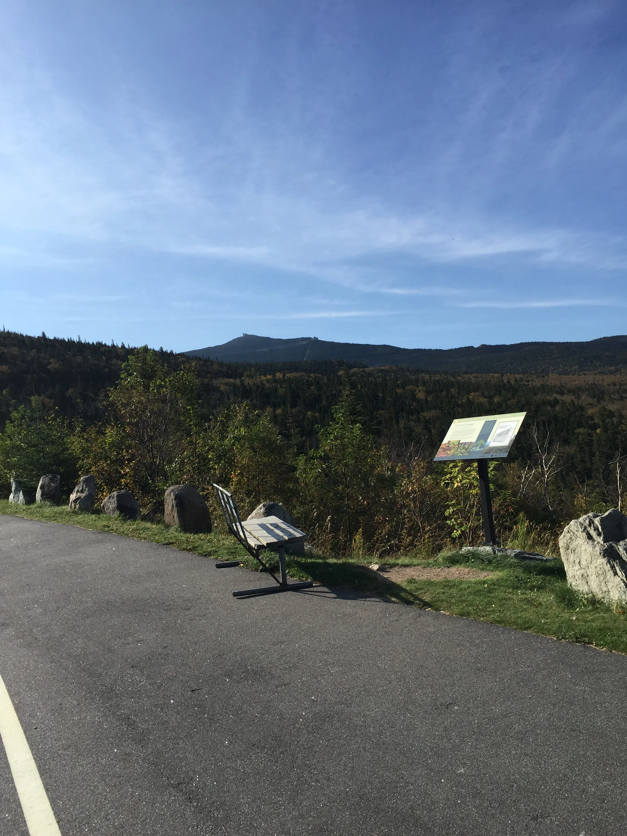
Being off the back I balanced the senses and the ride. The lower slope scented of baking fallen leaves and sweet fragrances of balsam fir groves. Taking deep breaths was rewarded with an effervescent cloud of relaxation. This would almost be relaxing if I didn’t choose to climb on a bike. On the left side of the road, upslope featured the sweet smelling fir groves. On the right side of the road, downslope, the groves of trees included birch and maple. Also off to the right were the miles and miles of carpeted wilderness freewheeling downhill all the way to Vermont and blending in with the hazy horizon. Seeing Montreal today was highly unlikely.
Time and again from the start of the ride the weather station and Summit Café glared down at us. It was a humbling reminder of the distance still needed to cover. Later a common thought while climbing included basic engineering. A couple of guys stated they tried to figure out just how the road wound back and forth to get to the top. Like Strava creates backyard meteorologists, Whiteface creates backyard slope highway experts feeling the need to occupy thoughts along an eight-mile climb. All I concluded was I should have had more for breakfast.
Getting closer and the summit felt so far away. While the summit was straight ahead, the road veered to the right while a cut in the trees displayed a cut from the left.
I regained contact with the rider in front of me. Glenn had been up this mountain before and I only caught him on account he drank in the views each time one was offered, meaning I caught him because he liked to take pictures. As the rider progresses upward there are more and more views of the eastern panorama. Glenn took advantage of a moment to photobomb a tourist hanging out of their car. He stated the tourists said they would beat him to the top.
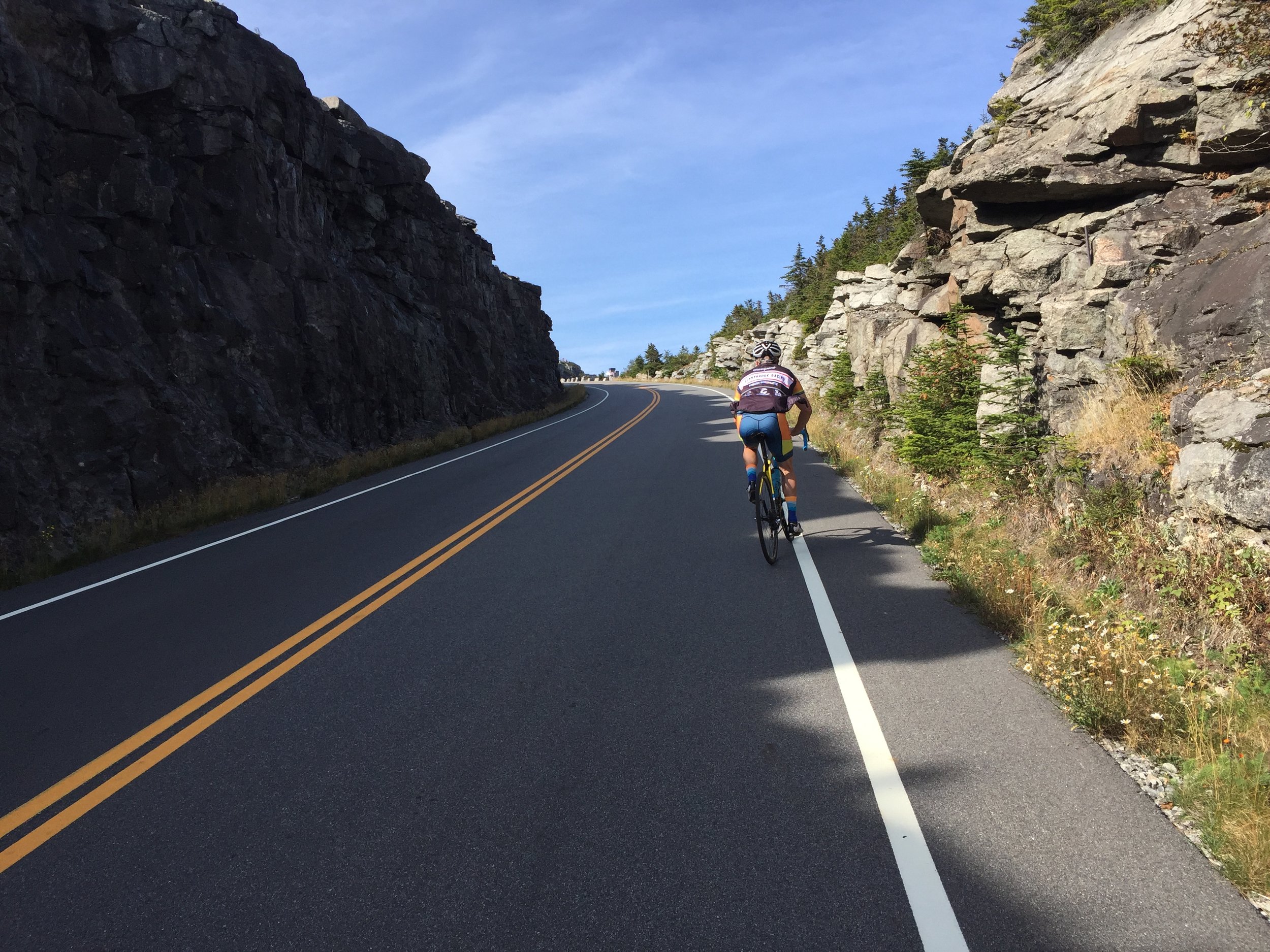
Once contacting Glenn I realized just how enjoyable challenges like these are. We made the dramatic switchback together, a rocky U-turn in the final mile of the climb. The summit had traded trees for granite. One theory is the granite summit gives Whiteface its name. The trees steadily declined in height as a cyclist continues upward. Progress can be counted in trees height.
Glenn plodding through the tunnel of granite. The summit of the highway is barely visible off of the left-side wall. Here we picked up a rather favorable tailwind.
A long sweeping right hander on the side of a ledge led us both into a rough granite trench on our way to the summit a quarter of a mile henceforth. Visible from this point were the gaggle of finishers in our group. I imagined they were all looking at their data to see how they fared among other attempts. I struggled through eight miles of eight percent and drank in the view as I lazily met up with our group. I prioritized going through the castle’s entrance and exit to make the summit official before talking to the others. The cooler breeze felt refreshing.
Naturally my first comment was, “So. Who made it up first?” In what could only be perceived as a joke, I was told Mike made it to the summit first. I could not believe it until the other guys stated he had, in fact, won the KOM among us. Perhaps it wasn’t disbelief but pride at the fact that Mike won the first HC climb of his career. Talk about taking advantage of a situation.
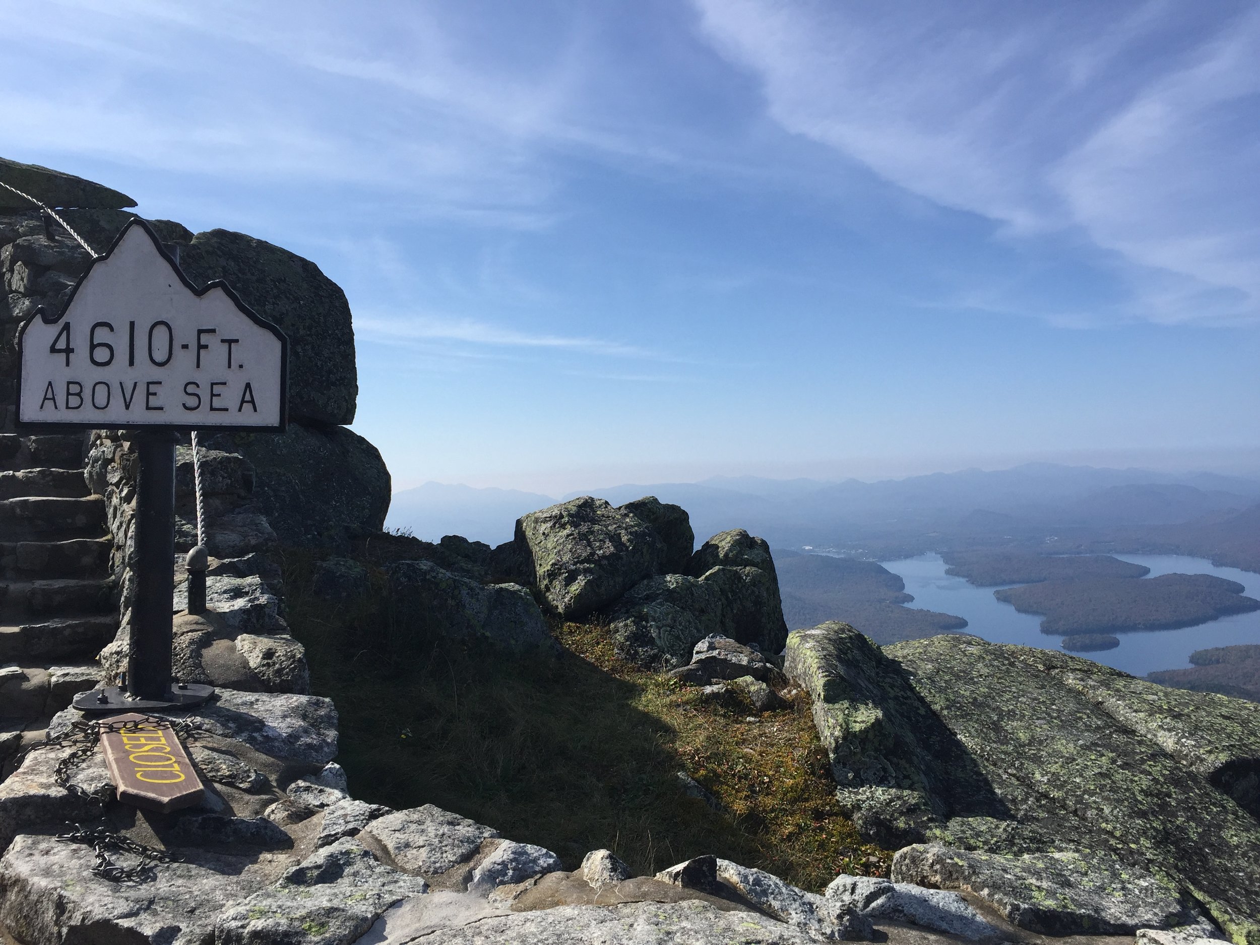
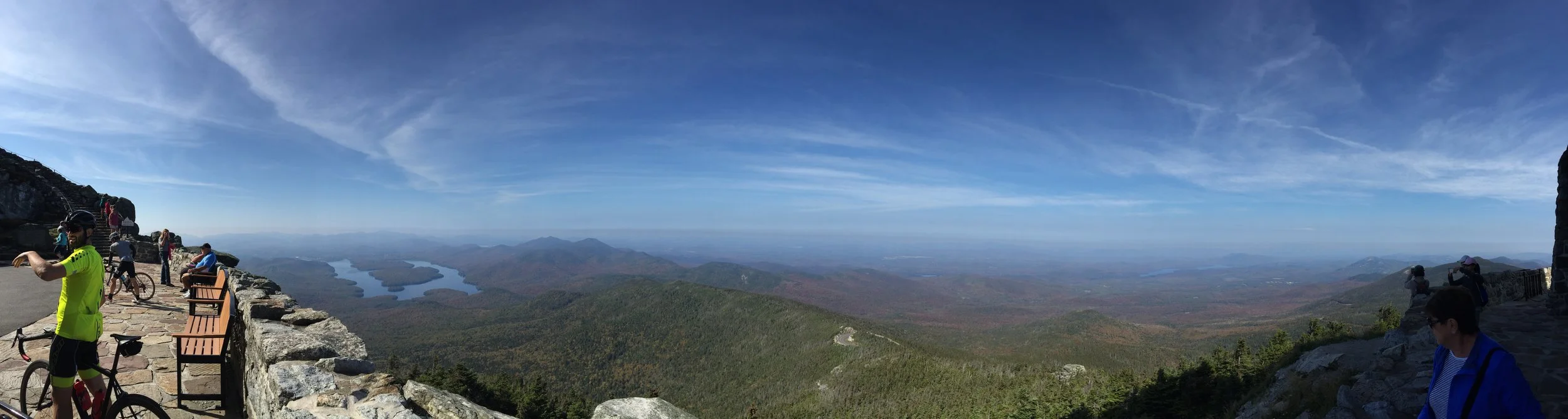
The quintessential photo taken by nearly every guy in our group: The sea level sign with Lake Placid proper in the background. The stairs led to the Summit Cafe.
We lingered at the road’s summit. Photos – multiple photos – were taken at the top next to the sign denoting the elevation above sea level. Naturally it is situated perfectly in front of Lake Placid proper. A cyclist, the elevation sign, and the lake were all featured in nearly every highway summit photo. Oh the places we go by bike. Oh the challenges we accept in our youth.
The lingering turned to excitement as we began to mull the descent. Mounting our bikes we queued behind three cars at the highway summit. Whether they were polite or the motorists recognized our ability to out-brake a car on the descent, all three cars moved aside and let us pass. What a feeling of being given the right-of-way in New York. Without going into detail the seven of us descended rather quickly. I am positive when I say we all imagined we were in the Tour descending the backside of the Alpe d’Huez chasing a phantom leader. Once at the bottom we refueled and then continued to make bad decisions. After the climb we thought it were a good idea to tack on another fifty miles.

One last photo before we departed of the summit castle.
Nothing can take away the fact we climbed a Tour de France stunt double by bike. Nothing can replace the feeling of limping home after an 85-mile trek around the northeastern portion of the Adirondacks from Lake Placid, up and down Whiteface, to Saranac Lake, and back home to Lake Placid. An HC climb stage is usually short, perhaps something around 85 miles such as the we did on September 23. Glenn, who told us about the comment the tourist made to him about getting to the top first, best summed up the ride:
When they arrived in their car well after Glenn had summited, he simply said to them, “Beat you.”